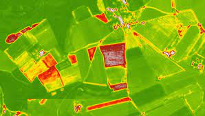
You already have the Planet images available for consultation and download at 4.7 meters resolution . And best of all, if you live in the equatorial zone and are tired of your satellite images having clouds ... the problem is over. Satellite images at maximum resolution thanks to Planet and the NICFI initiative available since 2015 and with a view to 2022 with possible renovations.
The Norwegian International Forestry and Climate Initiative ( NICFI ) has among its objectives the safeguarding and monitoring of the world's tropical forests. Within the program, the acquisition of high-resolution satellite images in the tropics , and their public release for free, is one of its purposes so that any user can contribute their bit in reducing the loss of forests, conserving the biodiversity and combat climate change. It is becoming clear to us that analyzing this data always has advantages
Baseline NICFI data is provided through Planet images from December 2015 to August 2020 (one tile every six months). And the following monitoring data from September 2020 to next August 2022 (a monthly mosaic).
In order to have the Planet images, you will need to access them from the QGIS plugin , the ArcGIS Pro plugin or directly and faster from Google Earth Engine .
You can directly and massively access the images from Google Earth Engine and filter dates like any other data collection. In this case, the images have the three visible bands and an additional NIR band that will be great for analyzing aspects related to vegetation using indices such as NDVI or SAVI .
The collections are available for the tropical areas of America , Africa and Asia individually, although you will need to request access permissions in Earth Engine being able to see the procedure in the description of the collection.
With simple scripts and RGB compositions, you will be able to view the Planet image data in high resolution and incorporate script fragments that allow you to download images by AOI area from the Tasks tasks tab .


0 Comments